

Lower Umatilla Basin Pollution Map

Click on the image above to view Oregon Rural Action’s interactive map of pollution in the Lower Umatilla Basin
The Lower Umatilla Basin Pollution Map was compiled by Oregon Rural Action staff and contains information about the many sources of pollution in the Lower Umatilla Basin Sacrifice Zone, which is one of the most polluted places in Oregon.
The map is fully interactive - click on anything in the map for more information or to see more photos of that pollution source.
Disclaimer:
This map was compiled by Oregon Rural Action (ORA) staff based on publicly available data from state and federal agencies. This map is provided as a general tool for public reference. The map is subject to change and is not warranted for any particular purpose. Oregon Rural Action makes no warranty, representation, or guarantee as to the content, sequence, accuracy, timeliness, or completeness of any of the data provided herein. ORA does not assume responsibility for any errors or omissions the map may contain and assumes no liability for the actions of map users based on information furnished from this map.
This map may change or evolve over time. Locations displayed within this map are approximate, and details will be updated periodically when new information becomes available.

Haga clic en la imagen de arriba para ver el mapa interactivo de contaminación de Oregon Rural Action en la Cuenca Baja de Umatilla
El Mapa de Contaminación de la Cuenca Baja de Umatilla fue compilado por Oregon Rural Action y contiene información sobre varias fuentes de contaminación en la Zona de Sacrificio de la Cuenca Baja de Umatilla, uno de los lugares más contaminados de Oregon.
El mapa es totalmente interactivo: haga clic en cualquier parte del mapa para obtener más información o ver más fotos de esa fuente de contaminación.
Descargo de responsabilidad:
Este mapa fue compilado por el personal de Oregon Rural Action (ORA) basándose en datos disponibles públicamente de agencias estatales y federales. Este mapa se proporciona como una herramienta general para referencia pública. El mapa está sujeto a cambios y no está garantizado para ningún propósito en particular. Oregon Rural Action no ofrece garantías ni declaraciones en relacion al contenido, la secuencia, la precisión, la puntualidad o la integridad de ninguno de los datos proporcionados en este documento. ORA no asume responsabilidad por los errores u omisiones que pueda contener el mapa y no asume responsabilidad por las acciones de los usuarios del mapa basado en la información proporcionada en este mapa.
Este mapa puede cambiar o evolucionar con el tiempo. Las ubicaciones que se muestran en este mapa son aproximadas y los detalles se actualizarán periódicamente cuando haya nueva información disponible.
Join us in building…
Safe Rural Water Communities
Agua Segura En Las Comunidades Rurales
Three Decades of Well Water Pollution in Rural Oregon Sees Almost No Government Action
Kotek visits Boardman residents with contaminated water for first time, hears frustrations, fears
Oregon Capital Chronicle - By Alex Baumhardt - May 4, 2023
Gov. Tina Kotek visits on May 3, 2023 with Boardman residents who have unsafe drinking water from nitrate contamination in their wells. (Alex Baumhardt/Oregon Capital Chronicle)
Important Media
Senator Merkley Highlights Contaminated Well Water in Rural Oregon
"Treat this as the emergency it is," Eastern Oregon residents, advocates call for state action on nitrates in well water
KAPP/KVEW - YakTriNews - Madeleine Hagen - April 21, 2023
Full article and video can be found on Apple Valley News Now or YouTube.
KGW-TV - Sick of waiting on state intervention, eastern Oregonians sue over groundwater contamination
KGW-TV - East Oregon’s Groundwater Pollution Crisis
Tainted Waters: Eastern Oregon's contaminated water crisis
Full Story | The Story | Nov. 21, 2023
Groundwater pollution is not just an eastern Oregon problem
| The Story | Nov. 22, 2023
"And this groundwater contamination problem, to me, is the most documentable environmental justice issues in the State..." -- Greg Pettit, retired DEQ administrator.
Timestamp: 3:14
Read more HERE
Thousands of eastern Oregonians face crisis of contaminated well water
| The Story | Nov. 13, 2023
Read more HERE
The Umatilla Basin's water crisis stems from industrial pollution, but it's hard to pin down one culprit
| The Story | Nov. 14, 2023
Read more HERE
Oregon regulators have had decades to tackle the Umatilla Basin's water pollution, but it's only gotten worse
| The Story | Nov. 15, 2023
Bottled water forever? Morrow and Umatilla residents want to see more action to solve groundwater pollution
| The Story | Nov. 16, 2023
Read more HERE
Investigation into burning of eastern Oregon clean water activist's truck now closed
Eastern Oregon water pollution: Your questions answered
| The Story | Nov. 17, 2023
Read more HERE
Read more HERE

Audio Recordings
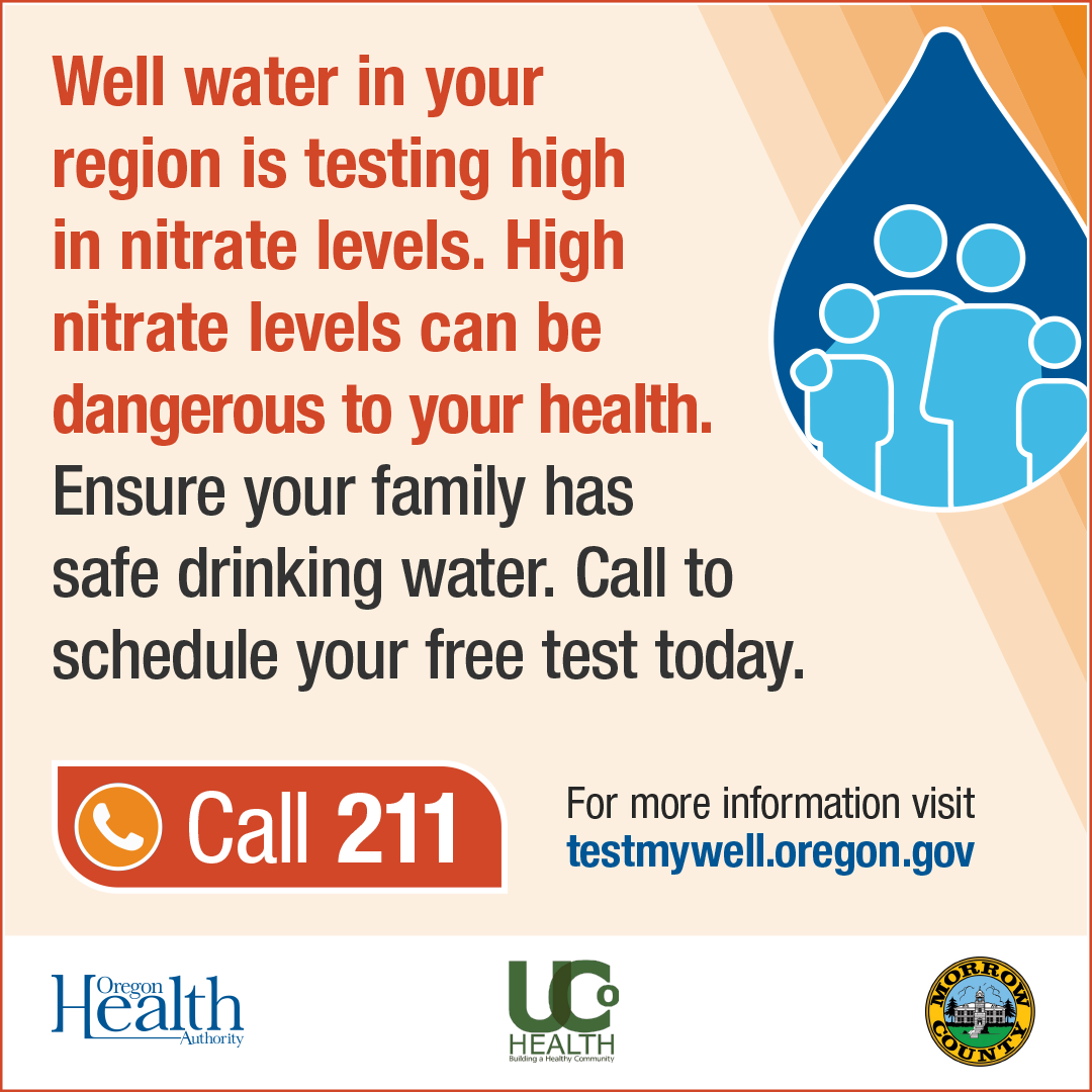
Click on the image for the Oregon Health Authorities’ website to sign up to get your well tested, or click HERE!
Schedule your Free Well test today!
¡Haga su cita para su prueba de pozo hoy!
HomeGrown Stories

ORA board member Mitch Wolgamott, former Department of Environmental Quality Acting Administrator Eastern Region.
In 1990, the Oregon DEQ declared the Lower Umatilla Basin (an area stretching from Morrow county to Umatilla county) a groundwater management area. In 1999, Threemile Canyon Farms moved into the area.
Samples taken from different test sites around the basin showed levels of nitrate-nitrogen exceeding the federal safe drinking water standard. In the early 2000s, Mitch directly oversaw the area of the Lower Umatilla Basin Groundwater Management Area working to reduce the nitrate levels in the area’s water.
High nitrate levels, above 10 parts per million (ppm), in drinking water can cause people to get sick, especially infants, the elderly and people with immune disorders. High nitrate levels reduce red blood cells’ ability to carry oxygen. This can cause methemoglobin in infants, the elderly and immune deficient individuals. Methemoglobin symptoms include headache, dyspnea, lightheadedness, weakness, confusion, palpitations and chest pain.
The levels of nitrate-nitrogen are particularly high in this area because of irrigation seepage into the groundwater. Grains, hay and grasses for livestock make up the majority of agriculture in the county.